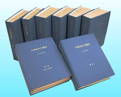
Geomorphologic Land Classification Maps of Flood-Stricken Areas by the late Dr.Oya.
About Geomorphologic Land Classification Maps of Flood-Stricken Areas by the late Dr.Oya.

NIED Library collects and preserves the Geomorphologic Land Classification Maps of Flood-Stricken Areas edited by the late Dr.Oya. These volumes (1-7) have 49 geomorphologic land classification maps and the supplementary volumes have 20 geomorphologic classification maps with explanatory documents and references. We are expecting researchers, government officers, and the general public as well as NIED researchers to be able to use these materials.
Contents
- Guide (Japanese)
- Entrance of the list on the Geomorphologic Land Classification Maps (Japanese)
Digital Maps
- Reconnaissance topographical survey map of lower part of the KISO river basin(jpg,910KB)
- Showing Classification of Flood Stricken Area (Japanese)
Japanese Toppage/Disaster Information Laboratory Toppage
NIED Disaster Information Laboratory
Tel : +81-29-863-7635 Email: